Manukau Harbour is a stunning natural wonder that's often overlooked in favour of more popular Auckland attractions. Its picturesque coastline and tranquil waters make it a perfect spot for a relaxing day out.
The harbour's unique shape is a result of its geological history, with the Manukau Heads forming the entrance to the harbour. The heads are made up of volcanic rock and have been shaped by millions of years of erosion.
As you explore the harbour, you'll notice the diverse range of wildlife that calls Manukau Harbour home. From dolphins and whales to penguins and seagulls, there's no shortage of fascinating creatures to spot.
Geography and Location
Manukau Harbour is nestled in the Auckland Region of New Zealand, lying to the southwest of the bustling Auckland isthmus.
The harbour opens out into the Tasman Sea, showcasing unique landform features shaped by geological processes over millions of years.
Its mouth is between Burnett Head and South Head, with the harbour mouth only 1800 metres wide.
A nine-kilometre channel leads to a roughly square basin 20 kilometres in width.
The harbour has a water surface area of 394 square kilometres and a tidal variation of up to 4 metres.
The harbour's shallowness and narrow mouth make navigating in or out of the harbour dangerous, especially with a bar at the mouth.
The harbour has three main arms: Māngere Inlet, Papakura Channel, and the Waiuku River, all contributing to its distinctive shape.
The Māngere Inlet lies close to Auckland's central city area, with the inner suburbs of Onehunga and Te Papapa situated close to its northern shore.
Auckland Airport is located close to the harbour's eastern shore.
The harbour reaches into Māngere Lagoon, which occupies a volcanic crater.
Ecological Importance
Manukau Harbour is a true ecological gem, supporting a diverse array of species and habitats that play a vital role in sustaining the environment.
The harbour's intricate network of channels and inlets creates a unique ecosystem that's home to over 20% of New Zealand's wader population.
Varied habitats such as sand and mud flats, mangrove forests, and coastal vegetation all contribute to the harbour's biodiversity.
From sand and mud flats to mangrove forests, each habitat plays a vital role in supporting different species.
The harbour's wetlands and coastal vegetation are crucial for local food webs, benefiting both bird and fish populations.
Here are some highlights of what makes Manukau Harbour a biodiversity hotspot:
- Varied Habitats: From sand and mud flats to mangrove forests, each habitat plays a vital role in supporting different species.
- Bird Diversity: Over 20% of New Zealand's wader population calls this area home, making it a key spot for birdwatching.
- Ecological Services: The harbour's wetlands and coastal vegetation contribute significantly to local food webs, benefiting both bird and fish populations.
Environmental Challenges
Manukau Harbour's ecosystem is under threat from environmental challenges.
Water quality has seen some improvement since 2001, but nutrient concentrations still exceed regional guidelines.
Elevated levels of contaminants like copper, lead, and zinc in marine sediments, particularly in the Māngere Inlet, are linked to historic industrial activities.
Heavy metal pollution complicates efforts to maintain water quality, even though mixing in the wider harbour dilutes these contaminants.
High nitrate levels in surface waters are exacerbated by over-fertilized and compacted rural soils, as well as invasive weeds and pests.
A collective effort is crucial to addressing these challenges, with groups like Sea Cleaners making significant strides in removing rubbish.
Environmental Challenges
Manukau Harbour faces significant environmental challenges, including water quality issues and pollution from historic industrial activities. Elevated levels of contaminants like copper, lead, and zinc in marine sediments have been detected, particularly in the Māngere Inlet.
Nutrient concentrations in the harbour still exceed regional guidelines, despite some improvement since 2001. Over-fertilized and compacted rural soils contribute to high nitrate levels in surface waters, which is exacerbated by invasive weeds and pests.
Heavy metal pollution complicates efforts to maintain water quality, and the loss of vegetation along the harbour threatens the ecosystem's health. Community and management efforts, including monitoring by Auckland Council and initiatives from the Manukau Harbour Forum, aim to address these challenges.
Groups like Sea Cleaners have made significant strides in removing rubbish, but ongoing vigilance is crucial to protect the harbour's ecosystem. Understanding these environmental challenges is essential for ensuring the future vitality of Manukau Harbour.
Here are some key statistics on the harbour's ecological health:
Environmental Outcomes
The environmental challenges we face today are complex and multifaceted, but understanding the outcomes of our actions can help us make positive changes.
Climate change is causing sea levels to rise at an alarming rate, with some areas experiencing a 15% increase in just a few decades.
As we lose biodiversity, ecosystems are becoming less resilient to extreme weather events, making it harder for species to adapt and survive.
The consequences of pollution are far-reaching, with plastic waste alone accounting for 8 million tons of marine debris each year.
The good news is that individual actions can add up to make a significant difference – for example, reducing meat consumption can lower greenhouse gas emissions by up to 50%.
Recreational Opportunities
Manukau Harbour offers a wealth of recreational opportunities that enhance the area's natural beauty and community spirit.
You can explore scenic walking and cycling trails like the Waikōwhai Walkway, which is a great way to enjoy the harbour's stunning scenery.
Enjoy family-friendly beaches such as French Bay Beach, which features playgrounds and picnic areas perfect for a relaxing day out with the kids.
Dive into water sports at Cornwallis Beach, where you can try water-skiing or wakeboarding for an adrenaline-packed adventure.
Pollock Wharf Road is a popular spot for fishing, and Awhitu Regional Farm Park is a great place for kayaking.
The beaches, like Blockhouse Bay Beach Reserve, provide perfect spots for family picnics, with barbecue areas and children's playgrounds to keep everyone entertained.
Ambury Farm Park offers trails and opportunities to see farm animals in a relaxed atmosphere, making it a great destination for nature lovers.
Here are some of the top recreational activities to enjoy at Manukau Harbour:
- Walking and cycling trails: Waikōwhai Walkway, Ambury Foreshore Track
- Family-friendly beaches: French Bay Beach, Blockhouse Bay Beach Reserve
- Water sports: Cornwallis Beach
- Fishing: Pollock Wharf Road
- Kayaking: Awhitu Regional Farm Park
- Picnicking: Blockhouse Bay Beach Reserve, Tamakae Reserve
- Camping: Clarks Beach Holiday Park, Ambury Regional Park
Cultural Heritage
Manukau Harbour's name originates from Māori traditions, with stories linking it to the voices of birds and the anxiety of Hoturoa navigating its entrance.
The harbour is spiritually significant, protected by the taniwha Paikea, which represents the deep spiritual connections that tangata whenua have with this land.
Sacred sites like pā, marae, and urupa dot the landscape, reflecting the values and beliefs of the community.
The harbour served as a vital resource for Māori, providing an abundance of food and connecting villages through various portages.
Even in areas where tangata whenua no longer reside, the spiritual ties to the land remain strong, emphasizing the importance of the environment.
The cultural heritage of Manukau Harbour encompasses historical narratives, arts, music, and language, all contributing to a collective identity.
Access and Management
Accessing the Manukau Harbour is a breeze, thanks to the well-developed road infrastructure, with State Highway 20 crossing the harbour.
The Manukau Transport Hub is the largest in South Auckland, offering frequent train services - six trains per hour at peak times.
You can also catch buses from Botany, Flat Bush, and Redoubt Road, with accessible routes available.
Both trains and buses are wheelchair-friendly, so everyone can enjoy the journey.
A unique perspective: Copenhagen Harbour Buses
Don't forget to grab an AT HOP card for discounts, especially if you're a full-time student.
Casual parking is available at 50 and 31 Manukau Station Road, starting at $3 per hour.
Day and evening rates are also offered, but keep in mind that long-term parking isn't an option here.
Feasibility Study and Outcomes
The Manukau Harbour Feasibility Study was completed by Tonkin & Taylor in 2024.
The Ministry of Transport released this study, which investigated the technical feasibility of establishing reliable and safe marine access to a large-scale port in the Manukau Harbour.
The study aimed to determine whether it would be possible to create a large-scale port in the harbour.
Explore further: Nuuk Port and Harbour
Geology and Hydrology
The Manukau Harbour's geology is a fascinating story of uplift and subsidence. It formed between 3 and 5 million years ago when tectonic forces between the Pacific Plate and Australian Plate uplifted the Waitākere Ranges.
The harbour began as an open bay, eventually forming as a sheltered harbour as elongated sand dune barriers formed at the harbour's mouth. These barriers are the result of millions of years of wind and water erosion.
Over the last two million years, the harbour has cycled between periods of being a forested river valley and a flooded harbour, depending on changes in the global sea level. This is a testament to the dynamic nature of the harbour's ecosystem.
The present harbour formed approximately 8,000 years ago, after the Last Glacial Maximum. This means that the harbour has been in its current form for thousands of years, shaping the landscape and creating a unique environment for plants and animals to thrive in.
Main Channels and Tides
Manukau Harbour's main channels and tides play a significant role in shaping its unique coastal landscape. The harbour's extensive network of channels and inlets creates a vital connection for navigation and ecology.
The Wairopa Channel hugs the northern shoreline, while the Purakau Channel, or South Channel, runs further out in the harbour. The Waiuku Channel leads to the Waiuku River in the south, and the Papakura Channel connects to Pahurehure Inlet in the southeast.
Tidal dynamics are crucial to understanding the harbour's navigation and marine activities. Between low and high tides, the water volume flowing between the Tasman Sea and the inner harbour ranges from 450 million cubic metres during neap tides to 690 million cubic metres during spring tides.
A fresh viewpoint: Paldiski South Harbour
Size and Tides
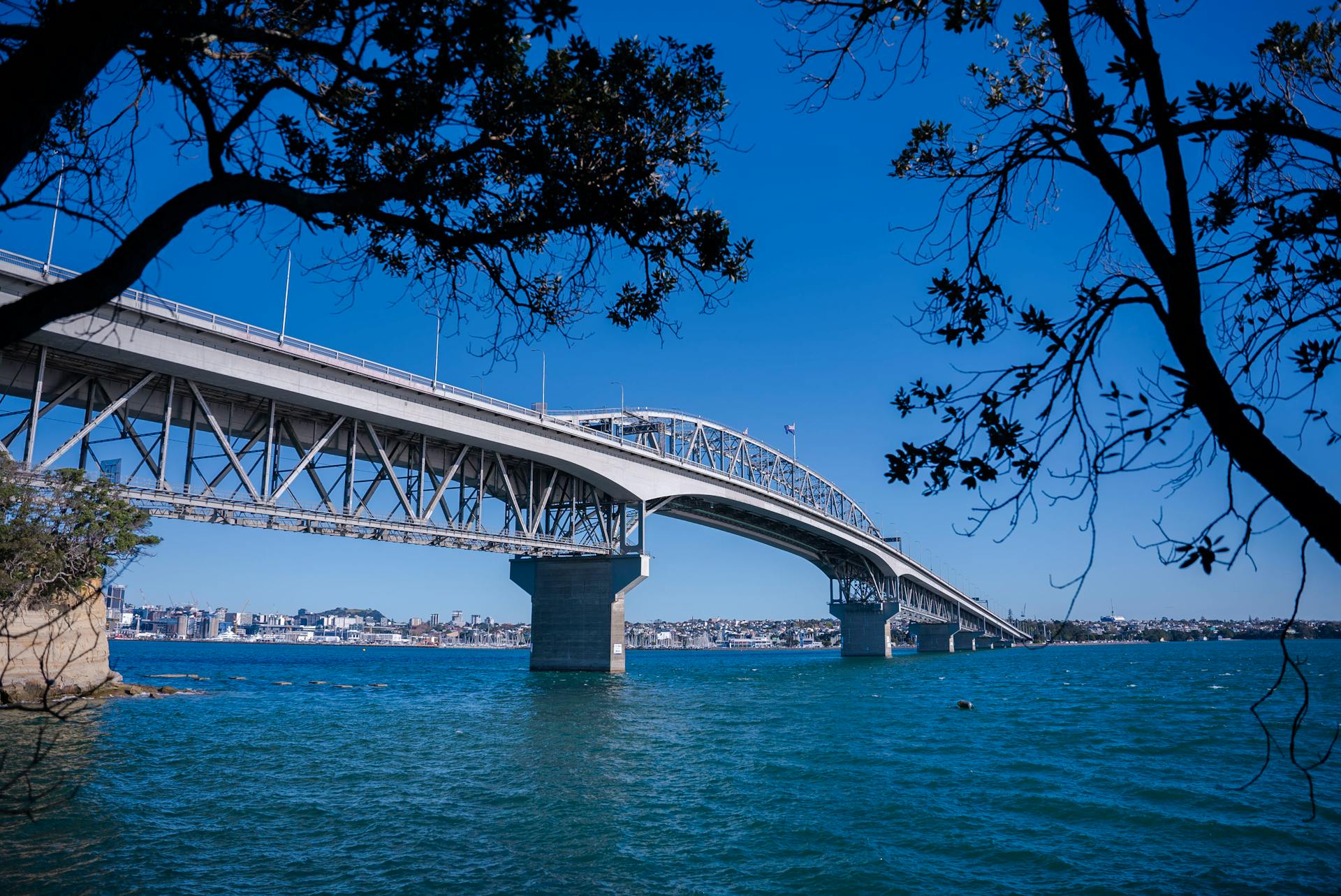
Manukau Harbour's size and tidal dynamics are truly fascinating. Covering approximately 365 km², the harbour expands to a water surface area of 394 km² at high tide but shrinks to just 195 km² at low tide.
The tidal patterns here are quite remarkable, with the water volume flowing between the Tasman Sea and the inner harbour ranging from 450 million cubic metres during neap tides to 690 million cubic metres during spring tides.
You'll notice that the harbour's size can fluctuate significantly, with tides rising and falling up to 12-18 feet.
This significant ebb and flow can take up to a month to completely flush the harbour, which is a pretty impressive sight to witness.
The highest tides can reach up to 3.3 metres, while the lowest can dip to 0.66 metres, making for a truly dynamic coastal experience.
Main Channels
The main channels of the harbour are a vital network for navigation and ecology, connecting various parts of this stunning coastal escape. The Wairopa Channel hugs the northern shoreline, while the Purakau Channel, or South Channel, runs further out in the harbour.
The Waiuku Channel leads you to the Waiuku River in the south, and the Papakura Channel connects to Pahurehure Inlet in the southeast. Each inlet has distinct characteristics, such as Mangere Inlet, which is highly modified due to port activities and land reclamation.
Pahurehure and Waiuku Inlets connect to their respective channels, while Harania and Tararata Creeks in the south remain largely intact, despite being disrupted by roads. Channel navigation is restricted by extensive tidal sandbanks.
The entrance channel is constricted and deep, splitting into four main channels in the central harbour. The controlling depth of these channels is 3.3 metres, making it crucial to stay aware of tidal volumes when exploring this unique coastal landscape.
A different take: South Harbour, Helsinki
Frequently Asked Questions
What is the Manukau Harbour used for?
The Manukau Harbour is a popular spot for fishing and sailing, with five active sailing clubs and local beaches used for water access.
How deep is Manukau Harbour?
Manukau Harbour's entrance channel is 30-50m deep, while the inner harbour is generally 30m deep, with shallower areas near the perimeter.
What is the Māori name for Manukau Harbour?
The Māori name for Manukau Harbour is Mānuka-o-Hotunui. This name is derived from the Māori language and reflects the harbour's cultural significance.
Sources
- https://en.wikipedia.org/wiki/Manukau_Harbour
- https://www.transport.govt.nz/area-of-interest/infrastructure-and-investment/manukau-harbour-feasibility-study
- https://ourauckland.aucklandcouncil.govt.nz/news/2024/06/achieving-better-environmental-outcomes-for-the-manukau-harbour/
- https://www.lawa.org.nz/explore-data/auckland-region/estuaries/manukau-harbour/
- https://explorepukekohe.co.nz/manukau-harbour/
Featured Images: pexels.com
