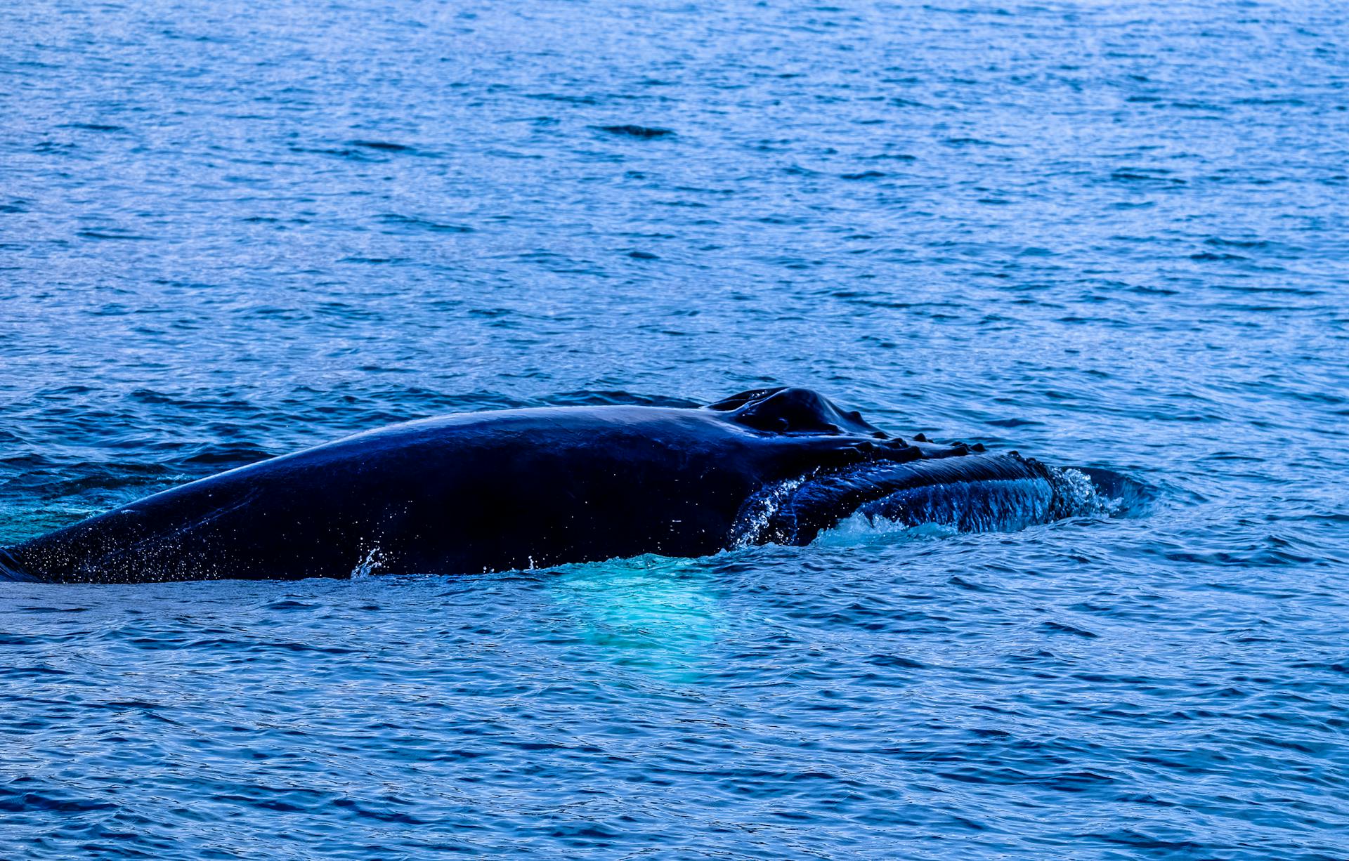
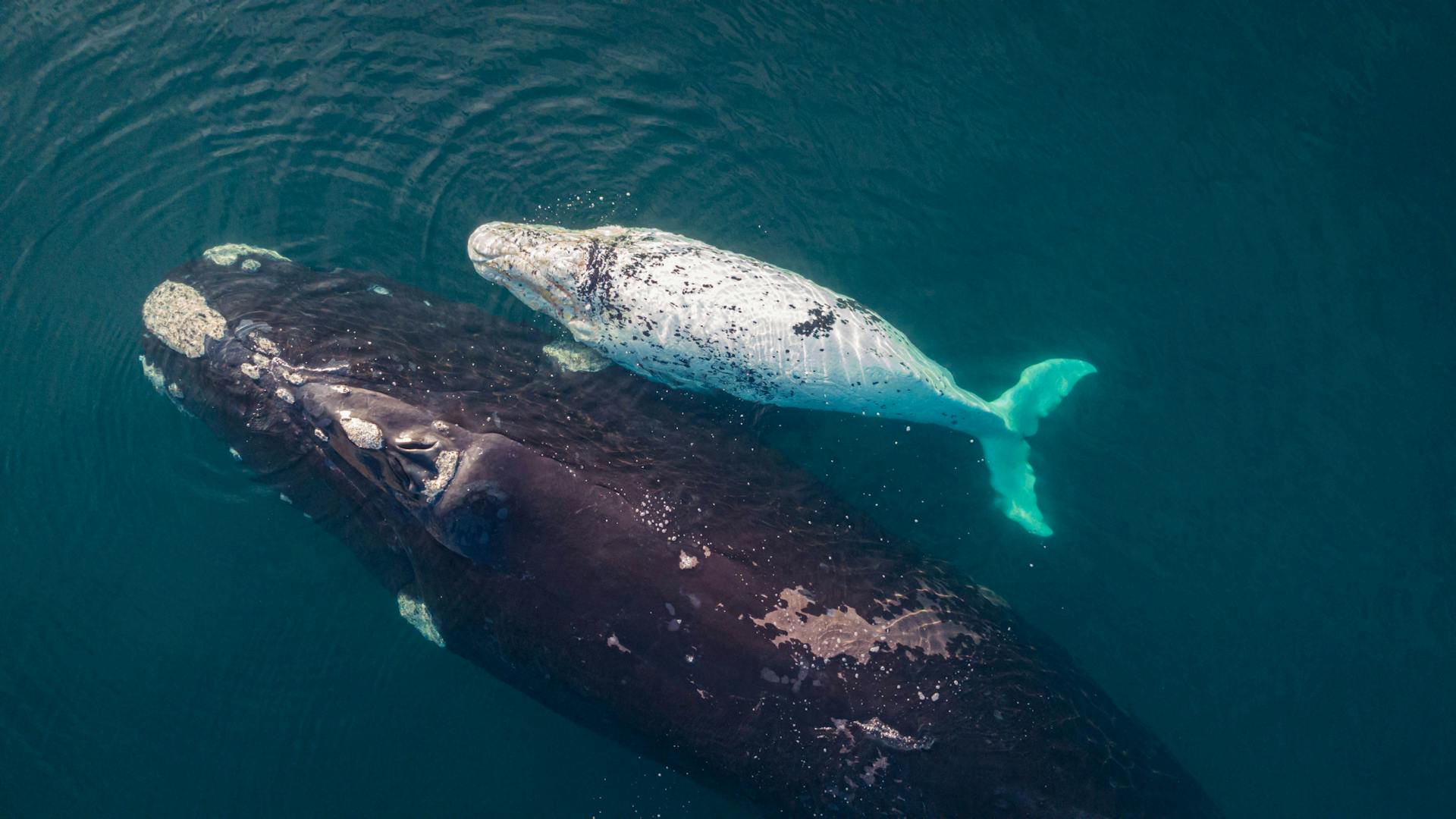
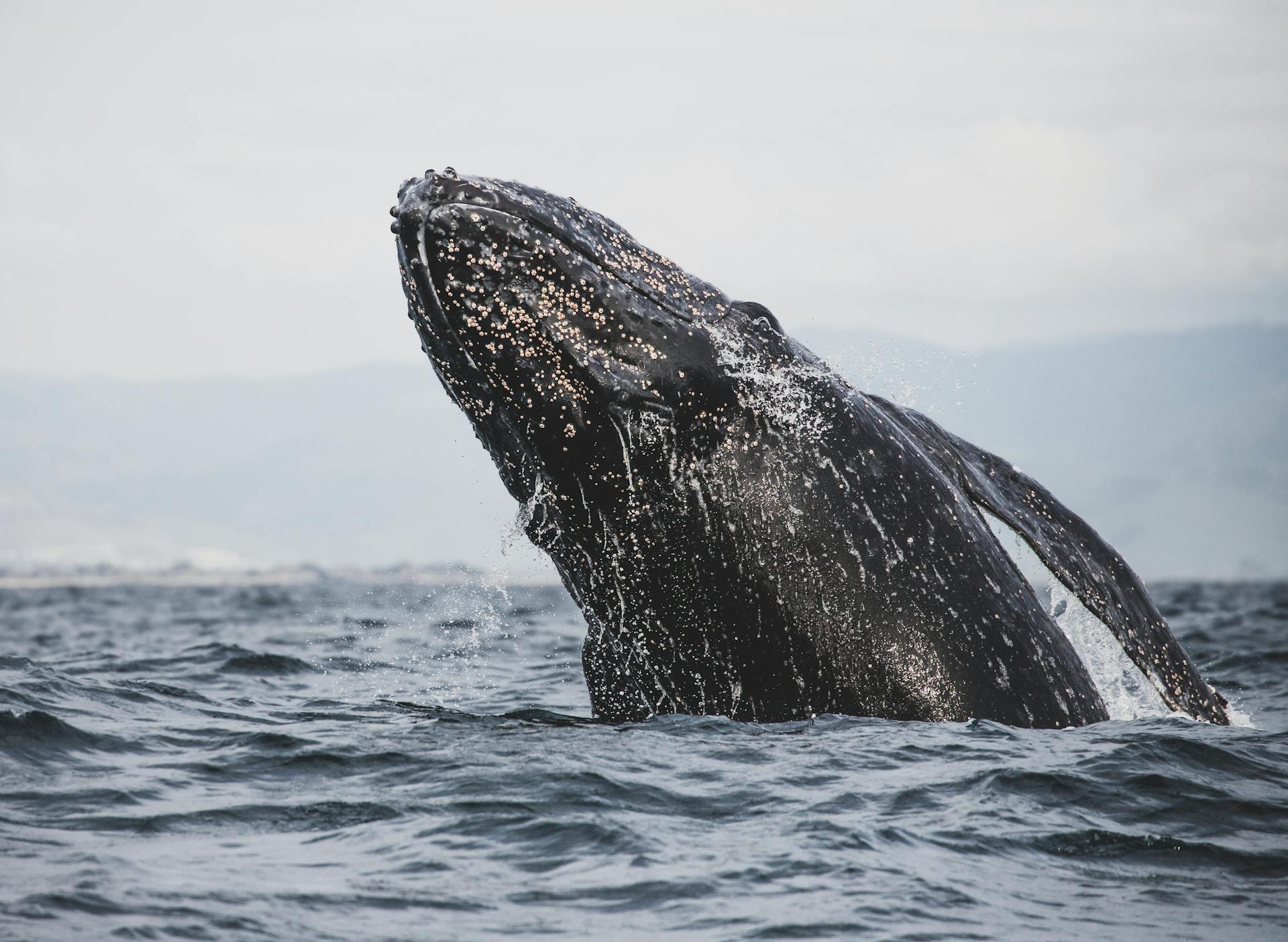
North Atlantic right whales are critically endangered, with only around 450 individuals remaining in the wild. They're found in the coastal waters of the North Atlantic Ocean.
To protect these magnificent creatures, the International Maritime Organization (IMO) has implemented speed restrictions for vessels in areas where right whales are known to frequent. In fact, the IMO has established a 10-knot speed limit for vessels in these areas.
These restrictions aim to reduce the risk of ship collisions with right whales, which can be fatal for the animals. A single ship collision can be devastating, causing significant injury or death.
Explore further: SS Atlantic Conveyor
Vessel Speed Regulations
Vessels 65 feet or longer must travel at 10 knots or less in certain locations along the U.S. East Coast, such as the Northeast Seasonal Management Areas, Mid Atlantic Seasonal Management Areas, and Southeast Seasonal Management Areas, at certain times of the year.
These areas are designated to reduce the threat of vessel collisions with endangered right whales.
A different take: Ship Management
The reduced speed is intended to lower the threat of vessel collisions with endangered right whales.
Vessels of all sizes are encouraged to slow to 10 knots or less within these areas as well.
The U.S. Coast Guard and NOAA's Office of Law Enforcement actively enforce the North Atlantic right whale vessel speed regulations.
Here are some of the technologies and strategies used to enforce the speed rule:
- Automatic Identification Systems to detect speeding
- Portable radar units to detect speeding by vessels not carrying AIS
- Active patrolling of Seasonal Management Areas
- Industry and public outreach to help prevent violations before they happen
NOAA has assessed $950,306 in civil penalties for vessels exceeding these regulations across 56 cases in 2022 and 2023.
Administrative monetary penalties of up to $250,000 or fines of up to $1,000,000 and imprisonment for up to 18 months may be imposed on vessel owners found liable for non-compliance with North Atlantic right whale speed restrictions or restricted areas.
Designated Zones and Measures
Designated zones and measures are in place to protect North Atlantic right whales. These zones include static zones, seasonal management areas, dynamic shipping zones, and restricted areas.
Static zones have a constant speed limit of 10 knots over ground to protect known whale habitats. This is crucial for preventing ship collisions and disturbances.
Seasonal management areas have specific speed regulations during peak whale presence periods. This is a critical measure to ensure the safety of both vessels and whales.
Dynamic shipping zones are monitored for whale activity, and speed restrictions are implemented when right whales are detected. Navigational warnings are also issued to mariners to alert them of the situation.
In restricted areas, vessel access is limited or prohibited to prevent disturbances and potential collisions. This is a necessary measure to protect the whales and their habitats.
Vessels over 13 metres in length are asked to voluntarily slow down or avoid certain areas on the Canadian east coast to increase protection of NARW. They are also requested to reduce speed to 10 knots over the ground from November 15 – December 31, 2025, if North Atlantic right whales are detected in the area and/or maritime conditions permit safe operation.
Broaden your view: A Whale (ship)
Risk Assessment and Modeling
The updated encounter risk model is a crucial tool in assessing the risk of ship collisions with North Atlantic right whales. It builds upon methods described in Garrison et al. and uses the same primary equation and model parameters.
The model is based on several inputs, including vessel and right whale data, characteristics, and behavior. These inputs are synthesized on a transit-by-transit basis to result in a binary output of mortality, given the presence of a whale in the same defined area as the transit.
The model is structured as an iterative simulation model, with probabilistic parameters drawn at each iteration as random variates from appropriate sampling distributions. We ran 1000 iterations to account for differences in these randomly selected parameters.
Consider reading: Importation Right
Encounter Risk Model
The encounter risk model is a crucial component of risk assessment and modeling, especially when it comes to understanding the likelihood of vessel strikes with whales.
This model builds upon methods described in Garrison et al., and uses the same primary equation and model parameters. It's based on several inputs including vessel and right whale data, characteristics, and behavior.
The model is structured as an iterative simulation model, with probabilistic parameters drawn at each iteration as random variates from appropriate sampling distributions.
Encounter rate is calculated for a time, which is equivalent to the number of seconds it takes for the vessel to transit a 10 × 10 km spatial grid cell. The encounter rate is equal to one when the vessel is within one body length (13.5 m) of the whale.
The probability of lethality, given a vessel strike occurs, is modeled using a logistic regression. This model found a significant relationship between the probability of whale mortality given that a strike occurs and vessel size, vessel speed, and whale species.
Vessel size and speed for each calculation are taken directly from the AIS data of the vessel segment. Probability of avoidance is only relevant to the equation when the encounter rate is equal to 1, the probability of the whale at the surface is equal to 1, and the probability of avoidance is equal to 0.
You might like: Us Mail Package Size Limits
Whale Density Model
The right whale density model is a crucial tool in assessing the risk of vessel strikes. It's based on a survey of right whale data spanning 1999-2020.
The model was built using the latest version (version 12) produced by Roberts et al., which was specifically designed to account for recent changes in right whale distribution. This includes their increasing presence in Mid-Atlantic U.S. waters and newly identified foraging habitat south of Nantucket Island in Southern New England.
The model spans from southern Florida to the Nova Scotian Shelf and was fit for three primary habitat regions: the Northeast U.S., the Mid-Atlantic U.S., and the Southeast U.S. Predictions are made on a 5 × 5 km grid, but were aggregated to a 10 × 10 km grid to match the resolution of previous analyses.
Right whales have been found to have high densities in the Mid-Atlantic and in southern New England and Cape Cod Bay during winter months.
Expand your knowledge: Atlantic Marine
Analysis and Simulation
Speed simulations have been used to analyze the impact of reduced vessel speeds on North Atlantic right whale mortality rates. The maximum benefit achieved from speed reductions was determined by comparing the "slow-all" scenario, where all non-exempt vessels travel at 9.5-10.0 knots, to the "real-world" scenario.
Researchers identified tracks from vessels traveling over 10 knots in specified spatial areas and applied a random speed reduction between 9.5 and 10.0 knots. This simulation assumed all non-exempt vessels adhered to the speed reduction.
Vessels exempt from speed regulations include those owned, operated, or contracted by the federal government, as well as U.S. military vessels and state law enforcement vessels engaged in enforcement or search and rescue activities.
To reduce the threat of vessel collisions with endangered right whales, vessels 65 feet or longer must travel at 10 knots or less in certain locations along the U.S. East Coast at certain times of the year. These areas include the Northeast, Mid Atlantic, and Southeast Seasonal Management Areas.
The reduced speed lowers the threat of vessel collisions with endangered right whales.
You might like: Atlantic (1849 Ship)
Specific Locations and Management
In specific locations along the U.S. East Coast, vessels 65 feet or longer must travel at 10 knots or less. This is to reduce the threat of vessel collisions with endangered right whales.
The designated locations for this speed restriction are called Seasonal Management Areas, which include the Northeast, Mid Atlantic, and Southeast areas. These areas are subject to speed limits at certain times of the year.
Vessels of all sizes are encouraged to slow down to 10 knots or less within these areas to minimize the risk of collisions with right whales.
Readers also liked: Right Storage
Right Whale Distribution
Right whales are most commonly found in the Mid-Atlantic and southern New England and Cape Cod Bay during winter months.
High densities of right whales are predicted in these areas from November through April, with the highest densities occurring in US waters during these months.
A significant portion of the population migrates to Canadian waters during the summer months.
The right whale density model used in this study, version 12, better differentiates densities predicted within Mid-Atlantic waters during cooler months compared to the previous version 9 model.
This improved model also provides density surfaces on a monthly time step corrected for effort and bias, resulting in a more accurate reflection of localized high-density levels within Nantucket shoals during the winter.
Cabot Strait
The Cabot Strait is a busy waterway that requires careful management to protect marine life.
During the North Atlantic Right Whale (NARW) migration season, there's a request for vessels to voluntarily reduce their speed to 10 knots over the ground.
This speed limit helps to minimize the risk of collisions between vessels and the whales.
It's a thoughtful gesture that acknowledges the importance of coexisting with these incredible creatures.
Outside Vessel Traffic Management Zones
Outside Vessel Traffic Management Zones, there's a special request for vessels to voluntarily reduce their speed to 10 knots over the ground when whales are detected in these areas. This is a crucial measure to prevent vessel collisions with endangered whales.
Vessels are asked to be mindful of their speed and reduce it to 10 knots or less when whales are spotted in these areas. It's a simple yet effective way to protect these magnificent creatures.
This voluntary speed reduction is a great example of how we can all work together to reduce the risk of vessel collisions with whales. By slowing down, we can make a big difference in their safety.
If you're a vessel operator, it's essential to be aware of your surroundings and adjust your speed accordingly when whales are detected in these areas.
Claim and Discussion
In the North Atlantic, ship collisions with right whales have been a significant concern for decades. The International Maritime Organization (IMO) has established speed restrictions to help mitigate this issue.
Speed limits have been implemented to reduce the risk of ship collisions with right whales. The restrictions are designed to give the whales a better chance of avoiding collisions.
If this caught your attention, see: Usps Shipping Restrictions by Country
Right whales can grow up to 52 feet in length, making them a large target for ships. This size difference makes it difficult for whales to avoid collisions with vessels.
The speed restrictions vary depending on the location and time of year. In certain areas, ships are required to travel at speeds of 10 knots or less.
Frequently Asked Questions
What is the right whale Amendment?
The Right Whale Coexistence Act of 2022, also known as the Right Whale Amendment, requires NOAA to provide financial assistance for projects reducing harm to North Atlantic right whales from human activities. This amendment aims to mitigate the lethal and sub-lethal effects of human activities on these endangered whales.
What is the 10 knot rule?
The Ship Strike Reduction Rule sets a maximum speed limit of 10 knots for vessels, unless necessary for safe maneuvering in restricted areas. This rule aims to reduce the risk of ship strikes with marine life.
Sources
- https://www.fisheries.noaa.gov/endangered-species-conservation/north-atlantic-right-whale-speed-zone-dashboard
- https://tc.canada.ca/en/marine-transportation/navigation-marine-conditions/protecting-north-atlantic-right-whales-collisions-vessels-gulf-st-lawrence
- https://thecurrentga.org/2023/07/25/fact-check-expanded-right-whale-speed-rules/
- https://www.gao.gov/products/gao-09-117r
- https://www.nature.com/articles/s41598-024-84886-z
Featured Images: pexels.com